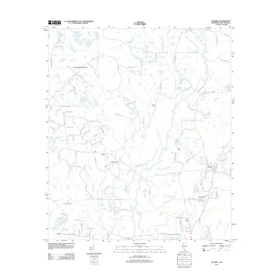
2012 Map of McNeill
USGS Topo · Published 2012About this map
McNeill and the nearby settlement of Hawthorne anchor this portion of Pearl River County, where the landscape is defined by a dense network of local roads and creek drainage systems. The presence of multiple small aviation facilities, including Hooper Skylark Field Airport, Langhurst Airport, Simpson Field Airport, and Greener Pastures Airpark, suggests a unique local transportation pattern and land use for this Mississippi region. These airfields are tucked between major water features like Hobolochitto Cr and Rocky Cr.
Find a feature on this map
147 named features on this map. Tap any name to fly to it.
Don’t see what you’re looking for? This feature index may not catch every label — zoom into the map to look around manually.
Map Details
Editions of this 2012 McNeill Map
This is the sole edition of this map. No revisions or reprints were ever made.
Other maps of this area

1942 · Walkiah Bluff
USGS Topo · 1:31,680

1942 · Pools Bluff
USGS Topo · 1:31,680

1949 · Bogalusa East
USGS Topo · 1:31,680

1953 · Mobile
USGS Topo · 1:250,000

1957 · Mobile
USGS Topo · 1:250,000

1958 · Picayune
USGS Topo · 1:62,500

1959 · Bogalusa
USGS Topo · 1:62,500

1959 · Poplarville
USGS Topo · 1:62,500

1960 · Mobile
USGS Topo · 1:250,000
1961 · Sun
USGS Topo · 1:62,500