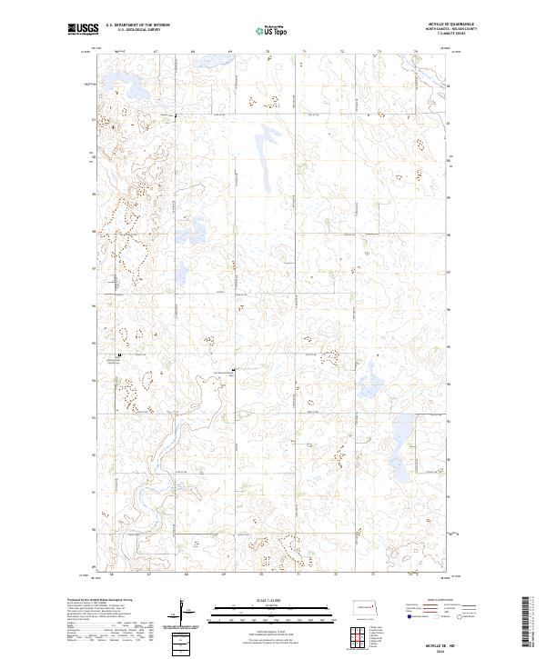
2024 Map of McVille SE
USGS Topo · Published 2024About this map
Melvin Cem and other small burial grounds dot this rural corner of Nelson County, illustrating the early 20th-century settlement patterns of the North Dakota plains. The landscape is defined by a dense network of sectional roads like Co Rd 5 and 27th St NE that divide a terrain rich in prairie potholes and seasonal wetlands. These natural features are preserved in part within the Nelson County Waterfowl Production Area, which spans several sections in the eastern portion of the map.
Find a feature on this map
26 named features on this map. Tap any name to fly to it.
Don’t see what you’re looking for? This feature index may not catch every label — zoom into the map to look around manually.
Map Details
Editions of this 2024 McVille SE Map
This is the sole edition of this map. No revisions or reprints were ever made.
Other maps of this area

1939 · Niagara
USGS Topo · 1:62,500

1942 · McVille
USGS Topo · 1:62,500

1952 · Grand Forks
USGS Topo · 1:250,000

1952 · New Rockford
USGS Topo · 1:250,000

1956 · New Rockford
USGS Topo · 1:250,000

1956 · Grand Forks
USGS Topo · 1:250,000

1961 · Kloten NW
USGS Topo · 1:24,000
1961 · McVille
USGS Topo · 1:24,000

1963 · Niagara SW
USGS Topo · 1:24,000
1963 · McVille SE
USGS Topo · 1:24,000