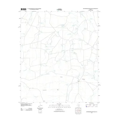
2012 Map of McWhorter Mountain
USGS Topo · Published 2012About this map
McWhorter Mountain and a prominent pass known as The Gap dominate this Sterling County landscape, where the geography is defined by its water management systems. In this cattle and sheep ranching region, the distribution of life-sustaining water is traced through an extensive network of stock tanks, such as the Usa Number One Tank, Limekiln Tank, and New Boatright Tank. The map reveals the infrastructure of remote Texas ranching through features like the Powell Sheep Camp and several named landmarks for drawing groundwater, including the Dempster Windmill and Divide Windmill. Drainage is channeled through the persistent beds of Renderbrook Creek and North Gasconades Creek, illustrating the environmental challenges and adaptations of West Texas land use in the early 21st century.
Find a feature on this map
47 named features on this map. Tap any name to fly to it.
Don’t see what you’re looking for? This feature index may not catch every label — zoom into the map to look around manually.
Map Details
Editions of this 2012 McWhorter Mountain Map
This is the sole edition of this map. No revisions or reprints were ever made.
Other maps of this area

1954 · Big Spring
USGS Topo · 1:250,000

1954 · San Angelo
USGS Topo · 1:250,000

1958 · San Angelo
USGS Topo · 1:250,000

1958 · Big Spring
USGS Topo · 1:250,000

1959 · Pecan Crossing
USGS Topo · 1:24,000

1959 · Spade Ranch
USGS Topo · 1:24,000

1959 · McWhorter Mountain
USGS Topo · 1:24,000

1959 · Dead Indian Mountain
USGS Topo · 1:24,000

1962 · Hyman NE
USGS Topo · 1:24,000

1963 · Cumbie Draw NE
USGS Topo · 1:24,000