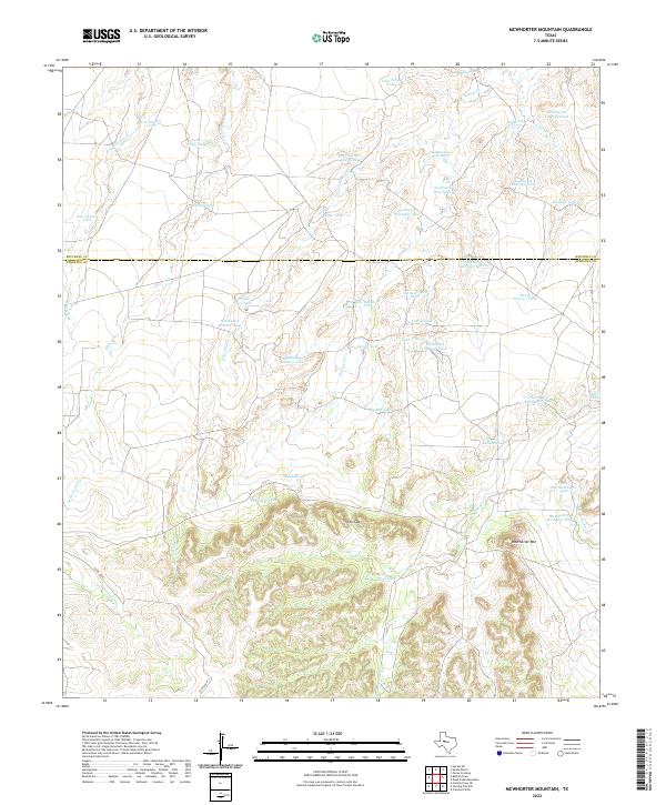
2022 Map of McWhorter Mountain
USGS Topo · Published 2022About this map
McWhorter Mountain dominates the southern landscape of this Sterling and Mitchell County borderlands map, rising above a complex network of seasonal drainages and stock management features. The terrain is characterized by high-plateau relief, notably at The Gap, where the elevation drops into a system of creeks including Renderbrook Cr and Willow Cr. This 2022 survey illustrates the modern ranching infrastructure of the Texas West, where numerous named water tanks—such as Old Boatright Tank and New McWhorter Tank—are essential for livestock in this arid environment. The scarcity of paved roads is evident, with only Co RD 305 P providing access through the southwestern sector. The drainage patterns of Antelope Cr and N Gasconades Cr further define the land's transition from the high ridges down to the intermittent stream beds that carve through the limestone-rich topography.
Find a feature on this map
45 named features on this map. Tap any name to fly to it.
Don’t see what you’re looking for? This feature index may not catch every label — zoom into the map to look around manually.
Map Details
Editions of this 2022 McWhorter Mountain Map
This is the sole edition of this map. No revisions or reprints were ever made.
Other maps of this area

1954 · Big Spring
USGS Topo · 1:250,000

1954 · San Angelo
USGS Topo · 1:250,000

1958 · San Angelo
USGS Topo · 1:250,000

1958 · Big Spring
USGS Topo · 1:250,000

1959 · Pecan Crossing
USGS Topo · 1:24,000

1959 · Spade Ranch
USGS Topo · 1:24,000

1959 · McWhorter Mountain
USGS Topo · 1:24,000

1959 · Dead Indian Mountain
USGS Topo · 1:24,000

1962 · Hyman NE
USGS Topo · 1:24,000

1963 · Cumbie Draw NE
USGS Topo · 1:24,000