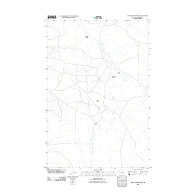
2011 Map of McWilliams Springs
USGS Topo · Published 2011About this map
McWilliams Springs and the surrounding high plains of Garfield County represent a landscape of isolated ranching and drainage networks. The terrain is defined by its coulees, or dry stream beds, such as Seider Coulee and McWilliams Coulee, which channel water toward larger arteries like Calf Creek. These ephemeral water sources were critical for early settlement, as evidenced by the namesake McWilliams Springs, Taylor Spring, and Geyser Spring. Notable landforms like Black Butte and Gumbo Ridge provide navigational landmarks across the open range. Human activity is marked by private holdings such as Dutton Ranch and Kincheloe Ranch, illustrating the sparse but enduring cattle-ranching footprint in this part of Montana.
Find a feature on this map
13 named features on this map. Tap any name to fly to it.
Don’t see what you’re looking for? This feature index may not catch every label — zoom into the map to look around manually.
Map Details
Editions of this 2011 McWilliams Springs Map
This is the sole edition of this map. No revisions or reprints were ever made.
Other maps of this area

1954 · Jordan
USGS Topo · 1:250,000

1954 · Forsyth
USGS Topo · 1:250,000

1956 · Jordan
USGS Topo · 1:250,000

1957 · Forsyth
USGS Topo · 1:250,000

1958 · Jordan
USGS Topo · 1:250,000

1958 · Forsyth
USGS Topo · 1:250,000

1962 · Kincheloe Ranch
USGS Topo · 1:24,000

1963 · Mc Williams Springs
USGS Topo · 1:24,000
1963 · Dutton Ranch
USGS Topo · 1:24,000

1963 · Regnal Coulee
USGS Topo · 1:24,000