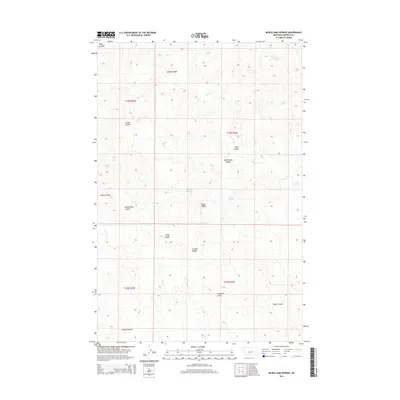
2014 Map of McWilliams Springs
USGS Topo · Published 2014About this map
McWilliams Springs and Taylor Spring serve as critical water points in this arid stretch of Garfield County. The landscape is defined by an intricate network of drainage features, including McWilliams Coulee, Studhorse Coulee, and Atkins Coulee, which carve through the high plains toward Calf Cr. Prominent rises such as Black Butte and the aptly named Gumbo Ridge provide navigational landmarks in a region largely dominated by open range and section-line roads. This 2014 survey illustrates the persistence of traditional Montana ranching geography, where named coulees and isolated springs like Geyser Spring dictate the movement of livestock and the placement of homesteads. The map covers portions of t14n r33e and surrounding townships, documenting a terrain where seasonal watercourses like Skeleton Cr and Diego Coulee shape the local environment.
Find a feature on this map
19 named features on this map. Tap any name to fly to it.
Don’t see what you’re looking for? This feature index may not catch every label — zoom into the map to look around manually.
Map Details
Editions of this 2014 McWilliams Springs Map
This is the sole edition of this map. No revisions or reprints were ever made.
Other maps of this area

1954 · Jordan
USGS Topo · 1:250,000

1954 · Forsyth
USGS Topo · 1:250,000

1956 · Jordan
USGS Topo · 1:250,000

1957 · Forsyth
USGS Topo · 1:250,000

1958 · Jordan
USGS Topo · 1:250,000

1958 · Forsyth
USGS Topo · 1:250,000

1962 · Kincheloe Ranch
USGS Topo · 1:24,000

1963 · Mc Williams Springs
USGS Topo · 1:24,000
1963 · Dutton Ranch
USGS Topo · 1:24,000

1963 · Regnal Coulee
USGS Topo · 1:24,000