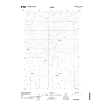
2020 Map of McWilliams Springs
USGS Topo · Published 2020About this map
McWilliams Springs and other vital water sources define this high plains landscape in Garfield County, where drainage patterns are etched into the earth through numerous coulees. The terrain is characterized by dramatic elevation changes, notably at Black Butte and the long stretch of Gumbo Ridge. This 2020 survey by the U.S. Geological Survey captures the isolated character of the Big Dry country, showing how seasonal and permanent water sources like Geyser Spring and Taylor Spring dictate the geography of the region.
Find a feature on this map
18 named features on this map. Tap any name to fly to it.
Don’t see what you’re looking for? This feature index may not catch every label — zoom into the map to look around manually.
Map Details
Editions of this 2020 McWilliams Springs Map
This is the sole edition of this map. No revisions or reprints were ever made.
Other maps of this area

1954 · Jordan
USGS Topo · 1:250,000

1954 · Forsyth
USGS Topo · 1:250,000

1956 · Jordan
USGS Topo · 1:250,000

1957 · Forsyth
USGS Topo · 1:250,000

1958 · Jordan
USGS Topo · 1:250,000

1958 · Forsyth
USGS Topo · 1:250,000

1962 · Kincheloe Ranch
USGS Topo · 1:24,000

1963 · Mc Williams Springs
USGS Topo · 1:24,000
1963 · Dutton Ranch
USGS Topo · 1:24,000

1963 · Regnal Coulee
USGS Topo · 1:24,000