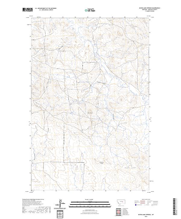
2024 Map of McWilliams Springs
USGS Topo · Published 2024About this map
McWilliams Springs sits at the heart of this Garfield County landscape, where the high plains are deeply dissected by a network of drainage features known locally as coulees. This contemporary survey by the U.S. Geological Survey illustrates a geography dominated by the sharp relief of Gumbo Ridge and the prominent landmark of Black Butte. The land is defined by its hydrology, with Calf Creek and various seasonal springs like Taylor Spring providing the rare water sources necessary for ranching in this part of Montana. The intricate pattern of McWilliams Coulee, Seider Coulee, and Studhorse Coulee reflects a terrain shaped by erosion, where the township and range boundaries of t14n r33e and its neighbors overlay a sparsely populated but geographically complex ranching territory.
Find a feature on this map
14 named features on this map. Tap any name to fly to it.
Don’t see what you’re looking for? This feature index may not catch every label — zoom into the map to look around manually.
Map Details
Editions of this 2024 McWilliams Springs Map
This is the sole edition of this map. No revisions or reprints were ever made.
Other maps of this area

1954 · Jordan
USGS Topo · 1:250,000

1954 · Forsyth
USGS Topo · 1:250,000

1956 · Jordan
USGS Topo · 1:250,000

1957 · Forsyth
USGS Topo · 1:250,000

1958 · Jordan
USGS Topo · 1:250,000

1958 · Forsyth
USGS Topo · 1:250,000

1962 · Kincheloe Ranch
USGS Topo · 1:24,000

1963 · Mc Williams Springs
USGS Topo · 1:24,000
1963 · Dutton Ranch
USGS Topo · 1:24,000

1963 · Regnal Coulee
USGS Topo · 1:24,000