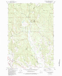
1979 Map of Meacham Corner
USGS Topo · Published 1979About this map
Mountaindale serves as a focal point for this landscape in the late 1970s, situated where the Southern Pacific rail line meets the foothills of the Tillamook State Forest. The community's social and historical fabric is visible through the Mountaindale School, Mountaindale Church, and a nearby Grange Hall. The terrain is deeply carved by the complex drainage system of the East Fork Dairy Creek and West Fork Dairy Creek, creating prominent ridges such as Pumpkin Ridge and elevated points like Bald Mountain.
Find a feature on this map
46 named features on this map. Tap any name to fly to it.
Don’t see what you’re looking for? This feature index may not catch every label — zoom into the map to look around manually.
Map Details
Editions of this 1979 Meacham Corner Map
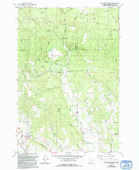
2 editions found
Other maps of this area

1915 · Hillsboro
USGS Topo · 1:62,500

1918 · Hillsboro
USGS Topo · 1:62,500

1922 · St. Helens
USGS Topo · 1:62,500

1940 · Hillsboro
USGS Topo · 1:62,500

1940 · Vernonia
USGS Topo · 1:62,500

1941 · St Helens
USGS Topo · 1:62,500

1941 · Gales Creek
USGS Topo · 1:62,500

1943 · Vernonia
USGS Topo · 1:62,500

1943 · St Helens
USGS Topo · 1:62,500

1948 · Vancouver
USGS Topo · 1:250,000