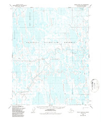
1955 Map of Meade River D-2
USGS Topo · Published 1987About this map
The National Petroleum Reserve in Alaska dominates this landscape, characterized by a dense network of thaw lakes and meandering waterways in the Arctic coastal plain. The Inaru River winds across the central and southern portions of the sheet, providing a primary drainage route for the surrounding wetlands. This 1950s era survey captures the traditional pathways across the permafrost, most notably the seasonal Winter Trail that cuts through the northwestern corner. Notable water bodies such as Kilusiktok Lake and Tractor Lake are prominent features in this lacustrine environment. To the northeast, Evulilivik Lake and the smaller Niklavik Creek further illustrate the intricate hydrology of the Meade River region during the mid-twentieth century.
Find a feature on this map
7 named features on this map. Tap any name to fly to it.
Don’t see what you’re looking for? This feature index may not catch every label — zoom into the map to look around manually.
Map Details
Editions of this 1955 Meade River D-2 Map
2 editions found
Other maps of this area

1945 · Barrow
USGS Topo · 1:250,000

1949 · Barrow
USGS Topo · 1:250,000

1951 · Meade River
USGS Topo · 1:250,000

1955 · Barrow
USGS Topo · 1:250,000

1955 · Meade River
USGS Topo · 1:250,000

1955 · Barrow A-4
USGS Topo · 1:63,360

1955 · Barrow A-5
USGS Topo · 1:63,360

1955 · Meade River C-1
USGS Topo · 1:63,360

1955 · Meade River D-2
USGS Topo · 1:63,360

1955 · Meade River C-3
USGS Topo · 1:63,360