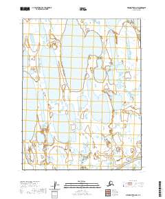
2020 Map of Meade River D-2 NW
USGS Topo · Published 2020About this map
Kilusiktok Lake dominates the upper-central landscape of this North Slope expanse, where the tundra is defined by a complex web of thaw lakes and interconnected wetlands. The terrain is relatively flat, and the hydrography is typical of the Arctic coastal plain, showing the shifting patterns of water across the permafrost. In the southern portion of the sheet, the Inaru River meanders eastward, serving as a primary drainage for the surrounding marshlands. To the west, the smaller Tractor Lake sits among a cluster of unnamed water bodies. This 2020 update from the U.S. Geological Survey utilizes high-resolution imagery to record the current state of these vital Arctic waterways.
Find a feature on this map
7 named features on this map. Tap any name to fly to it.
Don’t see what you’re looking for? This feature index may not catch every label — zoom into the map to look around manually.
Map Details
Editions of this 2020 Meade River D-2 NW Map
This is the sole edition of this map. No revisions or reprints were ever made.
Other maps of this area

1945 · Barrow
USGS Topo · 1:250,000

1949 · Barrow
USGS Topo · 1:250,000

1951 · Meade River
USGS Topo · 1:250,000

1955 · Barrow
USGS Topo · 1:250,000

1955 · Meade River
USGS Topo · 1:250,000

1955 · Barrow A-4
USGS Topo · 1:63,360

1955 · Barrow A-5
USGS Topo · 1:63,360

1955 · Meade River D-2
USGS Topo · 1:63,360

1955 · Meade River D-3
USGS Topo · 1:63,360
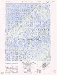
1962 · Meade River D-3
USGS Topo · 1:50,000