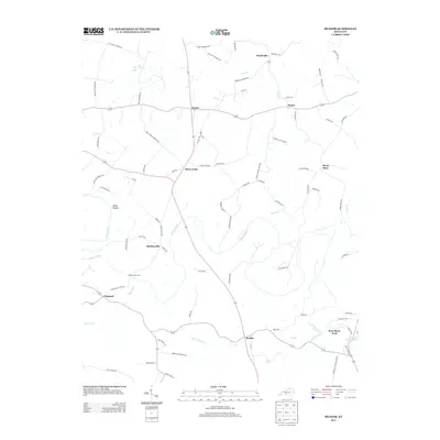
2013 Map of Meador
USGS Topo · Published 2013About this map
The Barren River meanders through this portion of Warren County, defining a landscape of agricultural settlements and river crossings in the early 21st century. Rural communities such as Kepler, Pondsville, and Meador serve as regional anchors, connected by a network of winding roads named for local families and landmarks. The geography is shaped by water, from the winding course of the river to the southern reaches of Barren River Lake. Evidence of earlier transport methods remains visible through labeled river crossings like Martinsville Ford and Port Oliver Ford, which historically linked these agrarian neighborhoods before modern bridge infrastructure. To the west, the terrain drops into Steep Hollow, while several small hamlets like Three Forks and Berry Store persist as named locations along the secondary routes branching away from the main river valley.
Find a feature on this map
79 named features on this map. Tap any name to fly to it.
Don’t see what you’re looking for? This feature index may not catch every label — zoom into the map to look around manually.
Map Details
Editions of this 2013 Meador Map
This is the sole edition of this map. No revisions or reprints were ever made.
Other maps of this area

1921 · Bowling Green
USGS Topo · 1:62,500

1922 · Brownsville
USGS Topo · 1:62,500

1922 · Mammoth Cave
USGS Topo · 1:62,500

1923 · Bowling Green
USGS Topo · 1:62,500

1923 · Mammoth Cave
USGS Topo · 1:62,500

1923 · Brownsville
USGS Topo · 1:62,500

1926 · Scottsville
USGS Topo · 1:62,500

1954 · Evansville
USGS Topo · 1:250,000

1954 · Austin
USGS Topo · 1:24,000

1954 · Bristow
USGS Topo · 1:24,000