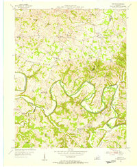
1954 Map of Meador
USGS Topo · Published 1955About this map
The Barren River carves a deep, winding path through this corner of Kentucky, where the counties of Warren, Allen, and Barren converge. In the mid-1950s, this landscape was defined by small agricultural settlements and the intricate drainage systems of Little Difficult Creek and Lick Branch. River crossings like Martinsville Ford and Port Oliver Ford remained critical local landmarks in a period when small-scale infrastructure still tied these rural communities together. The map reveals a high density of local institutions, including New Hope Ch, Flat Rock Ch, and schools like Three Forks Sch, which served the scattered population in places like Kepler and Doty. Evidence of local industry and commerce appears through scattered Oil Wells and the Berry Store, illustrating a self-sufficient economy before significant modern development altered the rural character of the region.
Find a feature on this map
38 named features on this map. Tap any name to fly to it.
Don’t see what you’re looking for? This feature index may not catch every label — zoom into the map to look around manually.
Map Details
Editions of this 1954 Meador Map
This is the sole edition of this map. No revisions or reprints were ever made.
Other maps of this area

1921 · Bowling Green
USGS Topo · 1:62,500

1922 · Brownsville
USGS Topo · 1:62,500

1922 · Mammoth Cave
USGS Topo · 1:62,500

1923 · Bowling Green
USGS Topo · 1:62,500

1923 · Mammoth Cave
USGS Topo · 1:62,500

1923 · Brownsville
USGS Topo · 1:62,500

1926 · Scottsville
USGS Topo · 1:62,500

1954 · Evansville
USGS Topo · 1:250,000

1954 · Austin
USGS Topo · 1:24,000

1954 · Bristow
USGS Topo · 1:24,000