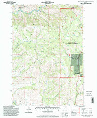
1995 Map of Meadow Brook Summit
USGS Topo · Published 1998About this map
The North Fork John Day River and the Middle Fork John Day River define the hydraulic character of this high-elevation landscape on the border of Umatilla and Grant counties. Much of the terrain is managed within the Umatilla National Forest, where steep drainages like Sulphur Gulch, Tamarack Canyon, and Bone Canyon provide natural corridors through the ridges. The survey identifies critical local water sources including Rush Pond, Gilson Pond, and dozens of scattered springs and stock ponds vital for land management. Resource extraction is evident through the presence of a Quarry and Gravel Pit near the prominent Meadow Brook Summit. The map serves as a record of the complex network of forest roads and light-duty trails that connect landmarks like Bone Point and the groves of Elk Grove during the mid-1990s.
Find a feature on this map
28 named features on this map. Tap any name to fly to it.
Don’t see what you’re looking for? This feature index may not catch every label — zoom into the map to look around manually.
Map Details
Editions of this 1995 Meadow Brook Summit Map
This is the sole edition of this map. No revisions or reprints were ever made.
Other maps of this area

1950 · Ritter
USGS Topo · 1:62,500

1951 · Dale
USGS Topo · 1:62,500

1952 · Ritter
USGS Topo · 1:62,500

1953 · Pendleton
USGS Topo · 1:250,000

1955 · Canyon City
USGS Topo · 1:250,000

1956 · Pendleton
USGS Topo · 1:250,000

1959 · Canyon City
USGS Topo · 1:250,000

1967 · Bridge Creek
USGS Topo · 1:24,000

1969 · Deerhorn Creek
USGS Topo · 1:24,000

1969 · Thompson Flat
USGS Topo · 1:24,000