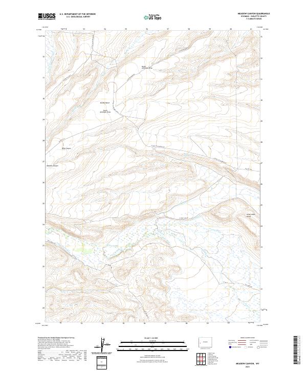
2021 Map of Meadow Canyon
USGS Topo · Published 2021About this map
N Piney Canal and N Piney Cr anchor a high-desert landscape defined by intricate water management systems in this modern survey of Sublette County. The terrain transitions from the broken topography of Dead Indian Dome and Meadow Canyon in the west to a valley floor saturated with historical irrigation features. Named waterworks like the Gilbert Warren Ditch, Dewey Ditch, Bluff Ditch, and Fleming Slough reveal the legacy of ranching and water rights in this arid region. The network of dirt tracks, including N Piney Cottonwood Rd and Star Corral Rd, provides access across Muddy Bench and through the draws where cattle and wildlife historically gathered near Bench Corral Springs.
Find a feature on this map
28 named features on this map. Tap any name to fly to it.
Don’t see what you’re looking for? This feature index may not catch every label — zoom into the map to look around manually.
Map Details
Editions of this 2021 Meadow Canyon Map
This is the sole edition of this map. No revisions or reprints were ever made.
Other maps of this area

1939 · Big Piney
USGS Topo · 1:125,000

1942 · Big Piney
USGS Topo · 1:125,000

1955 · Preston
USGS Topo · 1:250,000

1958 · Preston
USGS Topo · 1:250,000

1962 · Preston
USGS Topo · 1:250,000
1970 · Budd Reservoir
USGS Topo · 1:24,000
1970 · Big Piney West
USGS Topo · 1:24,000
1970 · Onion Springs
USGS Topo · 1:24,000
1980 · Red Castle Creek
USGS Topo · 1:24,000
1980 · Springman Creek
USGS Topo · 1:24,000