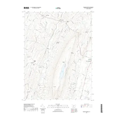
2019 Map of Meadow Grounds
USGS Topo · Published 2019About this map
McConnellsburg occupies the eastern edge of this landscape, where the valley floor meets the steep rise of Meadow Grounds Mtn. This area of Fulton County is defined by its dramatic ridges and narrow agricultural hollows, such as Lick Hollow and the drainage of Lick Run. The central portion of the map is dominated by the Meadow Grounds Lake and the long, linear peaks of Scrub Ridge and Sideling Hill. These landforms dictated the path of historical travel, funneling movement through gaps and along the base of the ridges.
Find a feature on this map
106 named features on this map. Tap any name to fly to it.
Don’t see what you’re looking for? This feature index may not catch every label — zoom into the map to look around manually.
Map Details
Editions of this 2019 Meadow Grounds Map
This is the sole edition of this map. No revisions or reprints were ever made.
Other maps of this area

1900 · Mercersburg
USGS Topo · 1:62,500

1902 · Mercersburg
USGS Topo · 1:62,500

1925 · Needmore
USGS Topo · 1:48,000

1930 · Broad Top
USGS Topo · 1:62,500

1933 · Broad Top
USGS Topo · 1:62,500

1935 · Needmore
USGS Topo · 1:62,500

1939 · Needmore
USGS Topo · 1:62,500

1939 · Orbisonia
USGS Topo · 1:62,500

1940 · Orbisonia
USGS Topo · 1:62,500

1942 · Hagerstown
USGS Topo · 1:125,000
Featured Places
- Ayr Township, PA
- Licking Creek Township, PA
- Belfast Township, PA
- Todd Township, PA
- Andover, Licking Creek Township