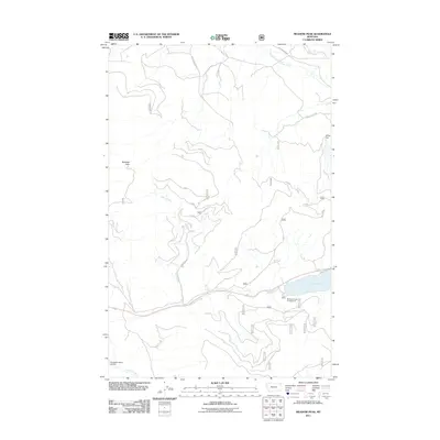
2011 Map of Meadow Peak
USGS Topo · Published 2011About this map
McGregor Lake and its surrounding drainages define the high country landscape of Flathead County in the early 21st century. The southeastern corner of the quadrangle serves as a recreational hub, anchored by the McGregor Lake Campground and residential access along Violet Bay Dr. The hydrology of the area is complex, with the McGregor Creek flowing toward the Thompson River, while the northern reaches are dominated by the Pleasant Valley Fisher River.
Find a feature on this map
33 named features on this map. Tap any name to fly to it.
Don’t see what you’re looking for? This feature index may not catch every label — zoom into the map to look around manually.
Map Details
Editions of this 2011 Meadow Peak Map
This is the sole edition of this map. No revisions or reprints were ever made.
Other maps of this area

1920 · Jennings
USGS Topo · 1:125,000

1935 · Thompson Lakes
USGS Topo · 1:96,000

1937 · Thompson Falls
USGS Topo · 1:125,000

1942 · Thompson Lakes
USGS Topo · 1:125,000

1956 · Wallace
USGS Topo · 1:250,000

1957 · Kalispell
USGS Topo · 1:250,000

1960 · Kalispell
USGS Topo · 1:250,000

1960 · Wallace
USGS Topo · 1:250,000

1961 · Kalispell
USGS Topo · 1:250,000

1964 · Meadow Peak
USGS Topo · 1:24,000