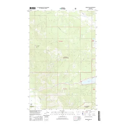
2017 Map of Meadow Peak
USGS Topo · Published 2017About this map
Meadow Peak serves as a prominent high point in this corner of northwest Montana, marking the rugged boundary where the Kootenai National Forest meets the Lolo National Forest. The landscape is defined by its complex drainage network, where the Thompson River and McGregor Cr carve through the terrain south of the expansive McGregor Lake. This 2017 survey illustrates the remote character of the Flathead Co / Sanders Co line, showing a region primarily dedicated to timber management and outdoor recreation. Human activity is concentrated along corridors like Thompson River Rd and near the Campbell Ranch Airport. To the north, the Pleasant Valley Fisher River and Pearson Reservoir anchor the hydrologic system, while local routes like Pleasant View Rd and Lost Prairie Rd provide access through the dense forest sections and across various creek crossings including Barnum Cr.
Find a feature on this map
21 named features on this map. Tap any name to fly to it.
Don’t see what you’re looking for? This feature index may not catch every label — zoom into the map to look around manually.
Map Details
Editions of this 2017 Meadow Peak Map
This is the sole edition of this map. No revisions or reprints were ever made.
Other maps of this area

1920 · Jennings
USGS Topo · 1:125,000

1935 · Thompson Lakes
USGS Topo · 1:96,000

1937 · Thompson Falls
USGS Topo · 1:125,000

1942 · Thompson Lakes
USGS Topo · 1:125,000

1956 · Wallace
USGS Topo · 1:250,000

1957 · Kalispell
USGS Topo · 1:250,000

1960 · Kalispell
USGS Topo · 1:250,000

1960 · Wallace
USGS Topo · 1:250,000

1961 · Kalispell
USGS Topo · 1:250,000

1964 · Meadow Peak
USGS Topo · 1:24,000