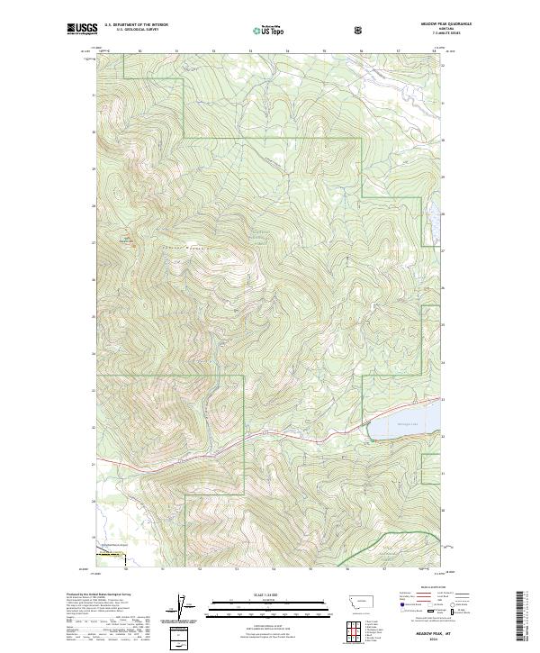
2024 Map of Meadow Peak
USGS Topo · Published 2024About this map
McGregor Lake dominates the southeastern portion of this landscape where the Flathead County and Sanders County line meets. This rugged montane environment is defined by the transition between the Kootenai National Forest and Lolo National Forest, with the high point at Meadow Peak rising above the Cabinet Mountains. The drainage of the Pleasant Valley Fisher River in the northeast and McGregor Creek in the south dictates the path of early corridors like Lost Prairie Rd and Pleasant View Rd. Private aviation is represented at the Campbell Ranch Airport in the south, while the complex system of forest routes, including the Natl Forest Develop Road 6725 Rd, illustrates the ongoing management of this timber-rich and mountainous region.
Find a feature on this map
18 named features on this map. Tap any name to fly to it.
Don’t see what you’re looking for? This feature index may not catch every label — zoom into the map to look around manually.
Map Details
Editions of this 2024 Meadow Peak Map
This is the sole edition of this map. No revisions or reprints were ever made.
Other maps of this area

1920 · Jennings
USGS Topo · 1:125,000

1935 · Thompson Lakes
USGS Topo · 1:96,000

1937 · Thompson Falls
USGS Topo · 1:125,000

1942 · Thompson Lakes
USGS Topo · 1:125,000

1956 · Wallace
USGS Topo · 1:250,000

1957 · Kalispell
USGS Topo · 1:250,000

1960 · Kalispell
USGS Topo · 1:250,000

1960 · Wallace
USGS Topo · 1:250,000

1961 · Kalispell
USGS Topo · 1:250,000

1964 · Meadow Peak
USGS Topo · 1:24,000