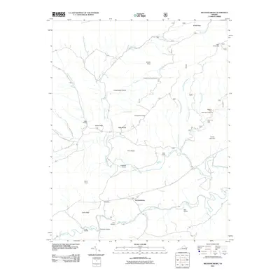
2011 Map of Mechanicsburg
USGS Topo · Published 2011About this map
Mechanicsburg sits at the heart of this Bland County landscape, where the valley floor meets the base of Turkey Ridge. The settlement pattern follows the contours of Walker Creek, with Crandon to the west and the more isolated Holly Brook tucked into the northern ridges. This 2011 survey reveals a territory shaped by its complex hydrology and verticality, from the high peaks of Double Mountain and Jenny Knob to the deep clefts of Longmeadow Hollow and Roland Chimney Hollow. A notable natural landmark, the Falls of Dismal, is situated along Dismal Creek near the Walnut Flats Campground. The map details a network of rural routes like State Rte 612 and State Rte 677 that connect these mountain communities and recreational sites, including the White Pines Horse Camp.
Find a feature on this map
45 named features on this map. Tap any name to fly to it.
Don’t see what you’re looking for? This feature index may not catch every label — zoom into the map to look around manually.
Map Details
Editions of this 2011 Mechanicsburg Map
This is the sole edition of this map. No revisions or reprints were ever made.
Other maps of this area

1887 · Pocahontas
USGS Topo · 1:125,000

1890 · Dublin
USGS Topo · 1:125,000

1891 · Pocahontas
USGS Topo · 1:125,000

1891 · Dublin
USGS Topo · 1:125,000

1894 · Pocahontas
USGS Topo · 1:125,000

1895 · Pocahontas
USGS Topo · 1:125,000

1913 · Peterstown
USGS Topo · 1:48,000

1913 · Bluefield
USGS Topo · 1:48,000

1916 · Bluefield
USGS Topo · 1:62,500

1916 · Peterstown
USGS Topo · 1:62,500