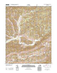
2013 Map of Mechanicsburg
USGS Topo · Published 2013About this map
Mechanicsburg and the rural settlements of Crandon and Holly Brook anchor this topographic study of Bland County, Virginia. The landscape is defined by its deep ridges and complex drainages, where family and place-named landmarks like Roland Chimney Hollow and Lickskillet Hollow suggest a long history of local habitation and lore. In the north, Brushy Ridge and Middle Ridge divide the terrain, while the southern reaches follow the course of Walker Creek near Skydusky Hollow. The map reveals a high concentration of named hollows and mountain gaps, such as Little Horse Gap, illustrating how the narrow valleys dictated the path of travel and settlement. Recreational areas like Walnut Flats Campground and the White Pines Horse Camp are located near Dismal Creek, emphasizing the importance of this drainage which also features the Falls of Dismal.
Find a feature on this map
49 named features on this map. Tap any name to fly to it.
Don’t see what you’re looking for? This feature index may not catch every label — zoom into the map to look around manually.
Map Details
Editions of this 2013 Mechanicsburg Map
This is the sole edition of this map. No revisions or reprints were ever made.
Other maps of this area

1887 · Pocahontas
USGS Topo · 1:125,000

1890 · Dublin
USGS Topo · 1:125,000

1891 · Pocahontas
USGS Topo · 1:125,000

1891 · Dublin
USGS Topo · 1:125,000

1894 · Pocahontas
USGS Topo · 1:125,000

1895 · Pocahontas
USGS Topo · 1:125,000

1913 · Peterstown
USGS Topo · 1:48,000

1913 · Bluefield
USGS Topo · 1:48,000

1916 · Bluefield
USGS Topo · 1:62,500

1916 · Peterstown
USGS Topo · 1:62,500