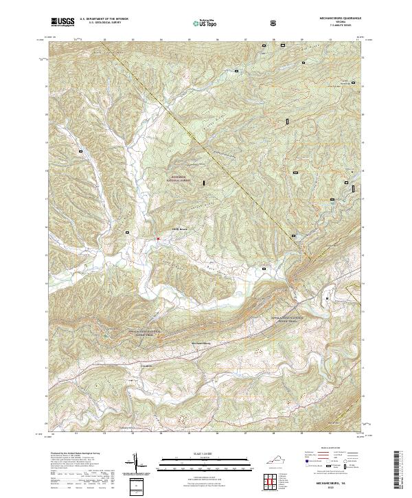
2022 Map of Mechanicsburg
USGS Topo · Published 2022About this map
Mechanicsburg and the rural communities of Holly Brook and Crandon occupy the valley floor between the high ridges of the Appalachian range in Bland County. The landscape is defined by the parallel elevations of Walker Mtn, Brushy Mtn, and Wolf Creek Mtn, which funnel the waters of Walker Creek and Kimberling Creek through the terrain. A significant portion of the area is protected as part of the Jefferson National Forest, where steep hollows like Lickskillet Hollow and Skydusky Hollow reveal the complex drainage patterns of the Virginia Highlands. The Appalachian National Scenic Trail winds along the crest of Brushy Mountain, passing notable landmarks such as Jenny Knob. For local historians and genealogists, the map identifies small family landmarks like Warden Cem and numerous named branches, including Stillhouse Spring Br, which offer clues to early mountain settlement and land use.
Find a feature on this map
70 named features on this map. Tap any name to fly to it.
Don’t see what you’re looking for? This feature index may not catch every label — zoom into the map to look around manually.
Map Details
Editions of this 2022 Mechanicsburg Map
This is the sole edition of this map. No revisions or reprints were ever made.
Other maps of this area

1887 · Pocahontas
USGS Topo · 1:125,000

1890 · Dublin
USGS Topo · 1:125,000

1891 · Pocahontas
USGS Topo · 1:125,000

1891 · Dublin
USGS Topo · 1:125,000

1894 · Pocahontas
USGS Topo · 1:125,000

1895 · Pocahontas
USGS Topo · 1:125,000

1913 · Peterstown
USGS Topo · 1:48,000

1913 · Bluefield
USGS Topo · 1:48,000

1916 · Bluefield
USGS Topo · 1:62,500

1916 · Peterstown
USGS Topo · 1:62,500