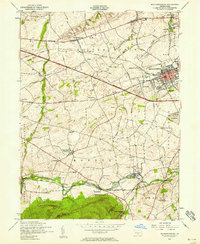
1952 Map of Mechanicsburg
USGS Topo · Published 1958About this map
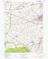
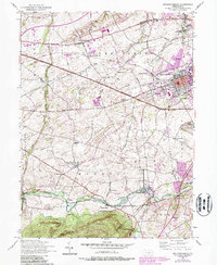
The Pennsylvania Turnpike cuts a bold line across this mid-century landscape, illustrating the rapid modernization of Cumberland County. While the turnpike and the Harrisburg Pike suggest a region in transition, the map preserves a dense network of local history, from the War of 1812 Memorial Cemetery to the historic Silver Spring Meeting House. Along the southern edge, the Yellow Breeches Creek winds past landmarks like the Allenberry Playhouse and the Williams Grove Park, providing a recreational counterpoint to the industrial and military presence at the US Naval Supply Depot. For genealogists, the sheet is exceptionally rich in educational landmarks, featuring numerous local schoolhouses such as Brindles School, Oak Grove School, and Heberlig School. This survey captures the intersection of the Reading railroad economy and the emerging interstate era, all while the Appalachian Trail skirts the high ground of Stony Ridge.
Find a feature on this map
63 named features on this map. Tap any name to fly to it.
Don’t see what you’re looking for? This feature index may not catch every label — zoom into the map to look around manually.
Map Details
Editions of this 1952 Mechanicsburg Map
6 editions found
Other maps of this area

1892 · Harrisburg
USGS Topo · 1:62,500

1899 · Harrisburg
USGS Topo · 1:62,500

1904 · Carlisle
USGS Topo · 1:62,500

1906 · New Cumberland
USGS Topo · 1:62,500

1907 · New Bloomfield
USGS Topo · 1:62,500

1924 · Harrisburg
USGS Topo · 1:62,500

1943 · New Cumberland
USGS Topo · 1:62,500

1943 · Harrisburg
USGS Topo · 1:62,500

1943 · New Bloomfield
USGS Topo · 1:62,500

1943 · Carlisle
USGS Topo · 1:62,500
Featured Places
- Middlesex Township, PA
- New Kingstown, Silver Spring Township
- Rosegarden, PA
- Mechanicsburg, PA
- Locust Point, Monroe Township