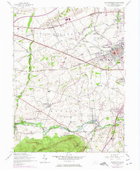
1952 Map of Mechanicsburg
USGS Topo · Published 1975About this map
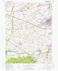
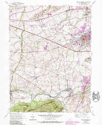
Mechanicsburg sits at the heart of this mid-century portrait of Cumberland County, where the transition from agricultural traditions to Cold War era infrastructure is clearly visible. The northern reaches are dominated by the U S Naval Supply Depot and the U S Naval Reservation, contrasting with the commemorative grounds of the War of 1812 Memorial Cemetery. To the south, the landscape softens into the meadows of Yellow Breeches Creek, a waterway flanked by recreation spots like Williams Grove Park and the Allenberry Playhouse.
Find a feature on this map
63 named features on this map. Tap any name to fly to it.
Don’t see what you’re looking for? This feature index may not catch every label — zoom into the map to look around manually.
Map Details
Editions of this 1952 Mechanicsburg Map
6 editions found
Other maps of this area

1892 · Harrisburg
USGS Topo · 1:62,500

1899 · Harrisburg
USGS Topo · 1:62,500

1904 · Carlisle
USGS Topo · 1:62,500

1906 · New Cumberland
USGS Topo · 1:62,500

1907 · New Bloomfield
USGS Topo · 1:62,500

1924 · Harrisburg
USGS Topo · 1:62,500

1943 · New Cumberland
USGS Topo · 1:62,500

1943 · Harrisburg
USGS Topo · 1:62,500

1943 · New Bloomfield
USGS Topo · 1:62,500

1943 · Carlisle
USGS Topo · 1:62,500
Featured Places
- Middlesex Township, PA
- New Kingstown, Silver Spring Township
- Rosegarden, PA
- Mechanicsburg, PA
- Locust Point, Monroe Township