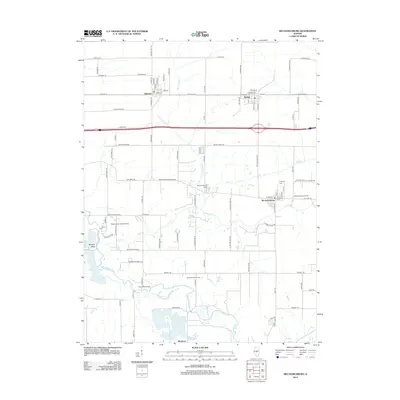
2012 Map of Mechanicsburg
USGS Topo · Published 2012About this map
The Sangamon River carves a winding path through the southwest corner of this central Illinois landscape, defining the sharp curve at Mowery Bend. This area of Sangamon County is anchored by the historic villages of Mechanicsburg, Buffalo, and Dawson, which are interconnected by a network of rural roads such as Old Route 36 and the Mechanicsburg Blacktop. The map reveals a legacy of local resource extraction, notably at the Mechanicsburg Oil Field and the Roby West Oil Field. Genealogists will find significant detail in the inclusion of the Mechanicsburg Cem and Pickerell Cem, while the presence of the Brentwood Landing Strip and Nazarene Acres Camp reflects the region's diverse rural development. From the northern reaches of N Fork Clear Cr down to the southern settlement of Buckhart, the map illustrates a stable agricultural and residential corridor defined by its waterways and small-town grids.
Find a feature on this map
92 named features on this map. Tap any name to fly to it.
Don’t see what you’re looking for? This feature index may not catch every label — zoom into the map to look around manually.
Map Details
Editions of this 2012 Mechanicsburg Map
This is the sole edition of this map. No revisions or reprints were ever made.
Other maps of this area

1907 · Springfield
USGS Topo · 1:62,500

1922 · Divernon
USGS Topo · 1:62,500

1923 · Taylorville
USGS Topo · 1:62,500

1924 · Divernon
USGS Topo · 1:62,500

1925 · Taylorville
USGS Topo · 1:62,500

1930 · Springfield
USGS Topo · 1:62,500

1940 · Springfield
USGS Topo · 1:62,500

1950 · Springfield East
USGS Topo · 1:24,000

1954 · Mechanicsburg
USGS Topo · 1:62,500

1958 · Decatur
USGS Topo · 1:250,000