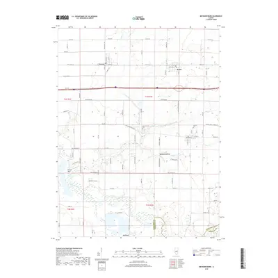
2018 Map of Mechanicsburg
USGS Topo · Published 2018About this map
Mechanicsburg and its surrounding agricultural landscape are defined by a network of creeks and the prominent sweep of the Sangamon River. In the southern portion of the quadrangle, the river meanders through a wide floodplain, creating distinctive features like "Mowery" Bend before its confluence with Buckhart Cr. The area is characterized by small, established settlements such as Buffalo, Dawson, and Buckhart, which are linked by historic thoroughfares like Old Rte 36 and the Mechanicsburg Blacktop. Local genealogy and land use patterns are evidenced by rural cemeteries including Mechanicsburg Cem and Pickerell Cem. The terrain is drained by several waterways, most notably N Fork Clear Cr and Griffith Cr, which cut through the level Illinois prairie to meet the primary river valley, shaping the layout of local roads and property boundaries.
Find a feature on this map
47 named features on this map. Tap any name to fly to it.
Don’t see what you’re looking for? This feature index may not catch every label — zoom into the map to look around manually.
Map Details
Editions of this 2018 Mechanicsburg Map
This is the sole edition of this map. No revisions or reprints were ever made.
Other maps of this area

1907 · Springfield
USGS Topo · 1:62,500

1922 · Divernon
USGS Topo · 1:62,500

1923 · Taylorville
USGS Topo · 1:62,500

1924 · Divernon
USGS Topo · 1:62,500

1925 · Taylorville
USGS Topo · 1:62,500

1930 · Springfield
USGS Topo · 1:62,500

1940 · Springfield
USGS Topo · 1:62,500

1950 · Springfield East
USGS Topo · 1:24,000

1954 · Mechanicsburg
USGS Topo · 1:62,500

1958 · Decatur
USGS Topo · 1:250,000