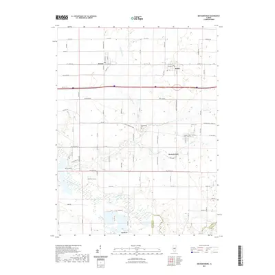
2021 Map of Mechanicsburg
USGS Topo · Published 2021About this map
Mechanicsburg stands as the central hub of this eastern Sangamon County landscape, where the agricultural grid is defined by historic corridors like the Mechanicsburg Blacktop. To the north, the parallel settlements of Dawson and Buffalo align with Old Rte 36, while the southern reaches are marked by the winding course of the Sangamon River and its tributary, Buckhart Cr. The map reveals a transition from the structured residential blocks of the towns to the broad bottomlands near Mowery Bend. Genealogists will find interest in the documented locations of Mechanicsburg Cem and Pickrell Cem, which serve as permanent markers of the area's long-established community roots. Drainage patterns are intricately mapped through systems such as Griffith Cr and the N Fork Clear Cr, showing how water management has shaped the land use between these rural villages.
Find a feature on this map
81 named features on this map. Tap any name to fly to it.
Don’t see what you’re looking for? This feature index may not catch every label — zoom into the map to look around manually.
Map Details
Editions of this 2021 Mechanicsburg Map
This is the sole edition of this map. No revisions or reprints were ever made.
Other maps of this area

1907 · Springfield
USGS Topo · 1:62,500

1922 · Divernon
USGS Topo · 1:62,500

1923 · Taylorville
USGS Topo · 1:62,500

1924 · Divernon
USGS Topo · 1:62,500

1925 · Taylorville
USGS Topo · 1:62,500

1930 · Springfield
USGS Topo · 1:62,500

1940 · Springfield
USGS Topo · 1:62,500

1950 · Springfield East
USGS Topo · 1:24,000

1954 · Mechanicsburg
USGS Topo · 1:62,500

1958 · Decatur
USGS Topo · 1:250,000