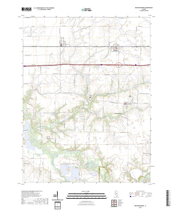
2024 Map of Mechanicsburg
USGS Topo · Published 2024About this map
Mechanicsburg and its surrounding agricultural landscape are defined by the winding course of the Sangamon River and its several tributaries. The area maintains a traditional Midwestern layout with settlements like Buffalo and Dawson situated along the historic corridor of Old Rte 36, reflecting the importance of this early regional transit route. Genealogists and local historians will find the Mechanicsburg Cem and Pickrell Cem notable landmarks on the prairie, while the river's path creates distinct geographic features such as Mowery Bend. The hydrology of the region is well-articulated, showing how North Fork Clear Creek and Griffith Creek drain the fertile lands between Sangamon Co and Christian Co. This modern survey documents the persistent rural character of the county, where long-standing roads like Mechanicsburg Blacktop and Mechanicsburg Rd continue to connect these quiet Illinois townships.
Find a feature on this map
41 named features on this map. Tap any name to fly to it.
Don’t see what you’re looking for? This feature index may not catch every label — zoom into the map to look around manually.
Map Details
Editions of this 2024 Mechanicsburg Map
This is the sole edition of this map. No revisions or reprints were ever made.
Other maps of this area

1907 · Springfield
USGS Topo · 1:62,500

1922 · Divernon
USGS Topo · 1:62,500

1923 · Taylorville
USGS Topo · 1:62,500

1924 · Divernon
USGS Topo · 1:62,500

1925 · Taylorville
USGS Topo · 1:62,500

1930 · Springfield
USGS Topo · 1:62,500

1940 · Springfield
USGS Topo · 1:62,500

1950 · Springfield East
USGS Topo · 1:24,000

1954 · Mechanicsburg
USGS Topo · 1:62,500

1958 · Decatur
USGS Topo · 1:250,000