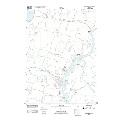
2010 Map of Mechanicville
USGS Topo · Published 2010About this map
The confluence of the Hudson River and Hoosic River anchor this 2010 survey of the Saratoga County riverfront, where the industrial legacy of Mechanicville meets the rural agricultural landscape. The town of Stillwater sits prominently on the west bank of the Hudson, connected to the surrounding countryside by historical road networks like Luther Rd and Ferry Ln. The presence of East Saratoga Junction and Stillwater Junction highlights the area's continued importance as a rail corridor, centered around the Union Depot. Extensive genealogical resources are mapped throughout the quadrangle, from family-named sites like Taylor Cemetery and Dunham Cemetery to church yards including the Yellow Meeting House Cemetery and Saint Peters Cemetery. The northern reaches of the map include a portion of Saratoga National Historical Park, preserving the ground of Bemis Heights and Middle Ravine.
Find a feature on this map
94 named features on this map. Tap any name to fly to it.
Don’t see what you’re looking for? This feature index may not catch every label — zoom into the map to look around manually.
Map Details
Editions of this 2010 Mechanicville Map
This is the sole edition of this map. No revisions or reprints were ever made.
Other maps of this area

1893 · Cohoes
USGS Topo · 1:62,500

1893 · Schenectady
USGS Topo · 1:62,500

1895 · Cohoes
USGS Topo · 1:62,500

1895 · Schenectady
USGS Topo · 1:62,500

1898 · Schenectady
USGS Topo · 1:62,500

1898 · Cohoes
USGS Topo · 1:62,500

1900 · Schuylerville
USGS Topo · 1:62,500

1902 · Saratoga
USGS Topo · 1:62,500

1929 · Cohoes
USGS Topo · 1:62,500

1930 · Schenectady
USGS Topo · 1:62,500