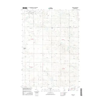
2017 Map of Mecosta
USGS Topo · Published 2017About this map
Mecosta and Remus serve as the primary hubs of this central Michigan landscape, which is defined by a dense network of sectional roads and glacial water bodies. The village of Mecosta is positioned along the Little Muskegon River in the northwest, while the community of Remus sits to the east, anchored by the intersection of 9 Mile Rd and local connectors. This 2017 survey details a transition from the structured township grids of Wheatland and Morton to the more modern, winding development patterns seen at Canadian Lakes. Genealogists will find several burial sites preserved across the countryside, including Saint Michael Cem near Pickerel Lake and Wamboldt Cem further south. The hydrography of the region is notably diverse, featuring the eastern flow of the Pine River and a string of smaller lakes such as Schoner Lake, Harris Lake, and the Black Lakes.
Find a feature on this map
52 named features on this map. Tap any name to fly to it.
Don’t see what you’re looking for? This feature index may not catch every label — zoom into the map to look around manually.
Map Details
Editions of this 2017 Mecosta Map
This is the sole edition of this map. No revisions or reprints were ever made.
Other maps of this area

1954 · Midland
USGS Topo · 1:250,000

1958 · Midland
USGS Topo · 1:250,000

1958 · Big Rapids
USGS Topo · 1:62,500

1959 · Midland
USGS Topo · 1:250,000

1959 · Howard City
USGS Topo · 1:62,500

1964 · Edmore
USGS Topo · 1:24,000

1964 · Six Lakes
USGS Topo · 1:24,000

1964 · Mecosta NW
USGS Topo · 1:24,000

1964 · Blanchard
USGS Topo · 1:24,000

1964 · Mecosta
USGS Topo · 1:24,000