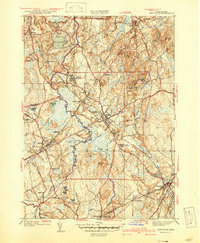
1940 Map of Medfield
USGS Topo · Published 1940About this map
The Charles River winds through a landscape of wetlands and wooded hills in this pre-war study of Norfolk County. The central town of Medfield serves as a local hub, supported by the New Haven and Hartford RR which intersects at Medfield Junction near the sprawling grounds of the Medfield State Hospital. To the west, the village of Millis sits near the Maple Swamp, while the southern reaches show the industrial and residential development of Walpole and West Walpole. Local recreation and sport are evident at the Norfolk Hunt Club, situated amidst the undulating terrain of Noanet Peak and Powisset Peak. For genealogists, the map clearly identifies several burial grounds including Pine Hill Cem and Vine Lake Cem, alongside small named water bodies like Bogastow Pond and Highland Lake that defined the early 20th-century character of these Massachusetts towns.
Find a feature on this map
81 named features on this map. Tap any name to fly to it.
Don’t see what you’re looking for? This feature index may not catch every label — zoom into the map to look around manually.
Map Details
Editions of this 1940 Medfield Map
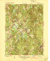
2 editions found
Other maps of this area

1886 · Dedham
USGS Topo · 1:62,500

1886 · Framingham
USGS Topo · 1:62,500

1887 · Franklin
USGS Topo · 1:62,500

1889 · Franklin
USGS Topo · 1:62,500

1889 · Framingham
USGS Topo · 1:62,500

1893 · Franklin
USGS Topo · 1:62,500

1893 · Boston
USGS Topo · 1:62,500

1894 · Dedham
USGS Topo · 1:62,500

1894 · Framingham
USGS Topo · 1:62,500

1903 · Boston
USGS Topo · 1:62,500