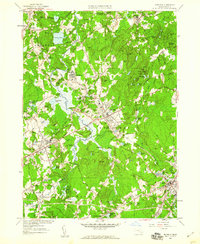
1957 Map of Medfield
USGS Topo · Published 1960About this map
The Charles River winds through this mid-century landscape of Norfolk and Middlesex Counties, defining the boundaries and character of settlements like Millis, Sherborn, and Medfield. This era shows a community defined by its institutional and natural landmarks, notably the sprawling Medfield State Hospital complex and the preserved grounds of the Rocky Woods Reservation. The map details the local infrastructure of the New Haven Railroad as it services stops like Farm Street Station and Medfield Junction, reflecting a transition toward suburban growth seen in developments like Crownridge Estates. Local history is preserved in numerous burial grounds, from the Vine Lake Cem to the Medfield State Hospital Cem. The varied topography includes landmarks such as Noanet Peak and Mount Misery, alongside numerous water bodies like South End Pond and Highland Lake that once supported local industry and recreation.
Find a feature on this map
80 named features on this map. Tap any name to fly to it.
Don’t see what you’re looking for? This feature index may not catch every label — zoom into the map to look around manually.
Map Details
Editions of this 1957 Medfield Map
2 editions found
Other maps of this area

1886 · Dedham
USGS Topo · 1:62,500

1886 · Framingham
USGS Topo · 1:62,500

1887 · Franklin
USGS Topo · 1:62,500

1889 · Franklin
USGS Topo · 1:62,500

1889 · Framingham
USGS Topo · 1:62,500

1893 · Franklin
USGS Topo · 1:62,500

1893 · Boston
USGS Topo · 1:62,500

1894 · Dedham
USGS Topo · 1:62,500

1894 · Framingham
USGS Topo · 1:62,500

1903 · Boston
USGS Topo · 1:62,500