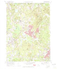
1970 Map of Medfield
USGS Topo · Published 1972About this map
The Charles River winds through this 1970 snapshot of Norfolk County, framing a landscape defined by historical town centers and significant institutional grounds. The extensive campus of the Medfield State Hospital occupies a prominent position north of Harding, while the Penn Central railroad corridors connect the primary settlements of Medfield and Millis. This era shows the suburban character of the region before further late-century development, preserving numerous local landmarks like the Library and several academic sites including Kingsbury High School and Wheelock School.
Find a feature on this map
156 named features on this map. Tap any name to fly to it.
Don’t see what you’re looking for? This feature index may not catch every label — zoom into the map to look around manually.
Map Details
Editions of this 1970 Medfield Map
2 editions found
Other maps of this area

1886 · Dedham
USGS Topo · 1:62,500

1886 · Framingham
USGS Topo · 1:62,500

1887 · Franklin
USGS Topo · 1:62,500

1889 · Franklin
USGS Topo · 1:62,500

1889 · Framingham
USGS Topo · 1:62,500

1893 · Franklin
USGS Topo · 1:62,500

1893 · Boston
USGS Topo · 1:62,500

1894 · Dedham
USGS Topo · 1:62,500

1894 · Framingham
USGS Topo · 1:62,500

1903 · Boston
USGS Topo · 1:62,500