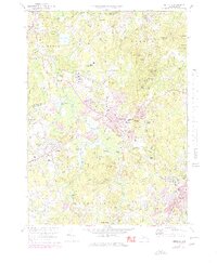
1970 Map of Medfield
USGS Topo · Published 1979About this map
The Charles River defines the winding border between Sherborn and Millis in this 1970s revision, a landscape of wetlands and residential growth. Central to the sheet is the significant campus of the Medfield State Hospital, located just north of Medfield Junction where Conrail rail lines intersect. The map documents the transition of the region from its agricultural and institutional roots toward more suburban density, highlighted by the concentration of public buildings and schools near the Medfield town center, including the Medfield Library and Dale St Sch.
Find a feature on this map
80 named features on this map. Tap any name to fly to it.
Don’t see what you’re looking for? This feature index may not catch every label — zoom into the map to look around manually.
Map Details
Editions of this 1970 Medfield Map
2 editions found
Other maps of this area

1886 · Dedham
USGS Topo · 1:62,500

1886 · Framingham
USGS Topo · 1:62,500

1887 · Franklin
USGS Topo · 1:62,500

1889 · Franklin
USGS Topo · 1:62,500

1889 · Framingham
USGS Topo · 1:62,500

1893 · Franklin
USGS Topo · 1:62,500

1893 · Boston
USGS Topo · 1:62,500

1894 · Dedham
USGS Topo · 1:62,500

1894 · Framingham
USGS Topo · 1:62,500

1903 · Boston
USGS Topo · 1:62,500