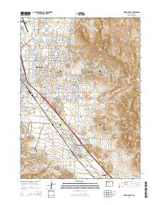
2014 Map of Medford East
USGS Topo · Published 2014About this map
Medford and its southeastern neighbors occupy this portion of the Bear Creek Valley during a period of significant urban and agricultural development. The landscape is defined by the critical water infrastructure of the Medford Irrigation District Canal and Talent Middle Canal, which support the region's orchards and fields. To the east, the terrain rises sharply toward Roxy Ann Peak and the Payne Cliffs, while the valley floor is punctuated by prominent landmarks like Barneburg Hill.
Find a feature on this map
112 named features on this map. Tap any name to fly to it.
Don’t see what you’re looking for? This feature index may not catch every label — zoom into the map to look around manually.
Map Details
Editions of this 2014 Medford East Map
This is the sole edition of this map. No revisions or reprints were ever made.
Other maps of this area

1891 · Ashland
USGS Topo · 1:250,000

1893 · Ashland
USGS Topo · 1:250,000

1897 · Ashland
USGS Topo · 1:250,000

1938 · Medford
USGS Topo · 1:125,000

1954 · Medford
USGS Topo · 1:62,500

1954 · Lakecreek
USGS Topo · 1:62,500

1954 · Talent
USGS Topo · 1:62,500

1954 · Ashland
USGS Topo · 1:62,500

1955 · Medford
USGS Topo · 1:250,000

1957 · Medford
USGS Topo · 1:250,000