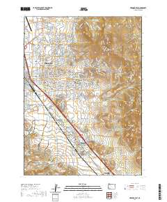
2020 Map of Medford East
USGS Topo · Published 2020About this map
Medford, Phoenix, and Talent anchor this 2020 map of Jackson County's urban and agricultural corridor. The landscape is defined by the complex water management systems of the Medford Irrigation District Canal, Talent Middle Canal, and Phoenix Canal, which support the orchards and agricultural lands surrounding the Bear Creek Corporation. The valley floor is tightly networked with residential development and transportation infrastructure, including the Central Oregon & Pacific RR and proximity to the Rogue Valley International - Medford Airport.
Find a feature on this map
151 named features on this map. Tap any name to fly to it.
Don’t see what you’re looking for? This feature index may not catch every label — zoom into the map to look around manually.
Map Details
Editions of this 2020 Medford East Map
This is the sole edition of this map. No revisions or reprints were ever made.
Other maps of this area

1891 · Ashland
USGS Topo · 1:250,000

1893 · Ashland
USGS Topo · 1:250,000

1897 · Ashland
USGS Topo · 1:250,000

1938 · Medford
USGS Topo · 1:125,000

1954 · Medford
USGS Topo · 1:62,500

1954 · Lakecreek
USGS Topo · 1:62,500

1954 · Talent
USGS Topo · 1:62,500

1954 · Ashland
USGS Topo · 1:62,500

1955 · Medford
USGS Topo · 1:250,000

1957 · Medford
USGS Topo · 1:250,000