Loading...
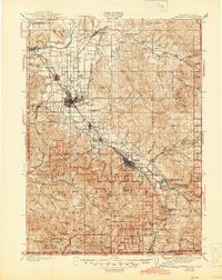
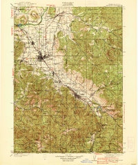
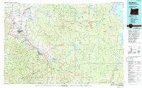
Loading map...1938 Map of Medford
USGS Topo · Published 1945About this map
Medford and the Rogue River valley serve as the anchor for this 1930s landscape, just as the regional orchard industry and transport networks were maturing. The Southern Pacific RR and the Pacific Highway corridor link the prominent valley settlements of Central Point, Phoenix, Talent, and Ashland. To the west, the historic mining district near Jacksonville is well-documented, featuring the Sterling Mine and Millionaire Mine, while the Site of Fort Lane marks a point of early frontier history near Tolo.
Find a feature on this map
146 named features on this map. Tap any name to fly to it.
Don’t see what you’re looking for? This feature index may not catch every label — zoom into the map to look around manually.
Map Details
Date Portrayed1938
Date Published1945
PublisherU.S. Geological Survey
Map TypeTopographic
Scale1:125,000
Physical Dimensions16.5 x 20.8 inches
Editions of this 1938 Medford Map
3 editions found

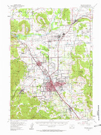
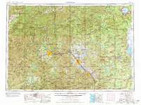
Historical Maps of Medford Through Time
6 maps found


Featured Locations
Source Details
SourceU.S. Geological Survey
CopyrightPublic Domain