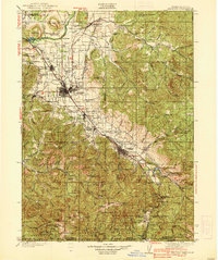
1938 Map of Medford
USGS Topo · Published 1938About this map
The Bear Creek Valley serves as the industrial and agricultural heart of this region, anchored by the burgeoning city of Medford and the historic settlement of Jacksonville. The 1930s landscape is defined by the Southern Pacific railroad corridor, which links a string of towns including Phoenix, Talent, and Ashland. To the north, the Rogue River flows past the prominent formations of Upper Table Rock and Lower Table Rock, where Bybee Bridge facilitates river crossing.
Find a feature on this map
142 named features on this map. Tap any name to fly to it.
Don’t see what you’re looking for? This feature index may not catch every label — zoom into the map to look around manually.
Map Details
Editions of this 1938 Medford Map
3 editions found

Other maps of this area

1886 · Shasta
USGS Topo · 1:250,000

1891 · Ashland
USGS Topo · 1:250,000

1893 · Ashland
USGS Topo · 1:250,000

1894 · Shasta
USGS Topo · 1:250,000

1897 · Ashland
USGS Topo · 1:250,000

1904 · Riddle
USGS Topo · 1:125,000

1908 · Grants Pass
USGS Topo · 1:125,000

1914 · Seiad
USGS Topo · 1:125,000

1922 · Shasta Valley Sheet No 15
USGS Topo · 1:24,000

1922 · Seiad
USGS Topo · 1:125,000