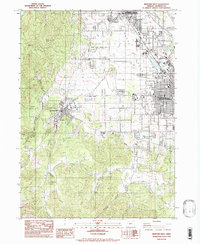
1983 Map of Medford West
USGS Topo · Published 1983About this map
Jacksonville and its expansive Jacksonville Historic District anchor the western edge of this valley survey, where the town's historical grid meets the rising slopes of Johns Peak. The landscape transitions from the urban density of Medford and Central Point in the east to the managed wilderness of the Rogue River National Forest. The region is defined by an intricate network of irrigation, including the Phoenix Canal and various unnamed ditches and laterals that support agricultural operations like the Medford Nursery.
Find a feature on this map
39 named features on this map. Tap any name to fly to it.
Don’t see what you’re looking for? This feature index may not catch every label — zoom into the map to look around manually.
Map Details
Editions of this 1983 Medford West Map
This is the sole edition of this map. No revisions or reprints were ever made.
Other maps of this area

1891 · Ashland
USGS Topo · 1:250,000

1893 · Ashland
USGS Topo · 1:250,000

1897 · Ashland
USGS Topo · 1:250,000

1908 · Grants Pass
USGS Topo · 1:125,000

1938 · Medford
USGS Topo · 1:125,000

1954 · Medford
USGS Topo · 1:62,500

1954 · Gold Hill
USGS Topo · 1:62,500

1954 · Talent
USGS Topo · 1:62,500

1954 · Ruch
USGS Topo · 1:62,500

1955 · Medford
USGS Topo · 1:250,000