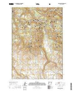
2020 Map of Medical Springs
USGS Topo · Published 2020About this map
The settlement of Pondosa and the neighboring Medical Springs anchor the southeastern corner of this map, reflecting a landscape defined by timber, ranching, and the natural geothermal activity of Medical Hot Spring. Much of the terrain is dominated by the Whitman National Forest, where a network of seasonal routes including the High Ridge Xc Ski and the 900 Road Snowmobile trails trace the high elevations near Frazier Mtn.
Find a feature on this map
49 named features on this map. Tap any name to fly to it.
Don’t see what you’re looking for? This feature index may not catch every label — zoom into the map to look around manually.
Map Details
Editions of this 2020 Medical Springs Map
This is the sole edition of this map. No revisions or reprints were ever made.
Other maps of this area

1901 · Baker City
USGS Topo · 1:125,000

1906 · Telocaset
USGS Topo · 1:125,000

1955 · Baker
USGS Topo · 1:250,000

1955 · Grangeville
USGS Topo · 1:250,000

1959 · Baker
USGS Topo · 1:250,000

1959 · Grangeville
USGS Topo · 1:250,000

1965 · China Cap
USGS Topo · 1:24,000

1965 · Flagstaff Butte
USGS Topo · 1:24,000

1965 · Union
USGS Topo · 1:24,000

1965 · Medical Springs
USGS Topo · 1:24,000