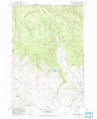
1993 Map of Medical Springs
USGS Topo · Published 1993About this map
Medical Springs serves as the focal point of this Union County survey, situated at the base of the mountains where Big Creek and McCurdy Creek converge. The landscape is defined by the high elevations of the Whitman National Forest, featuring prominent peaks such as Reeves Mtn, Frazier Mtn, and Sugarloaf Mtn. The map reveals a network of water resources and small settlements, including Wisdom and Bondosa, which are connected by a system of 4WD trails and light-duty roads through the timber.
Find a feature on this map
32 named features on this map. Tap any name to fly to it.
Don’t see what you’re looking for? This feature index may not catch every label — zoom into the map to look around manually.
Map Details
Editions of this 1993 Medical Springs Map
This is the sole edition of this map. No revisions or reprints were ever made.
Other maps of this area

1901 · Baker City
USGS Topo · 1:125,000

1906 · Telocaset
USGS Topo · 1:125,000

1955 · Baker
USGS Topo · 1:250,000

1955 · Grangeville
USGS Topo · 1:250,000

1959 · Baker
USGS Topo · 1:250,000

1959 · Grangeville
USGS Topo · 1:250,000

1965 · China Cap
USGS Topo · 1:24,000

1965 · Flagstaff Butte
USGS Topo · 1:24,000

1965 · Union
USGS Topo · 1:24,000

1965 · Medical Springs
USGS Topo · 1:24,000