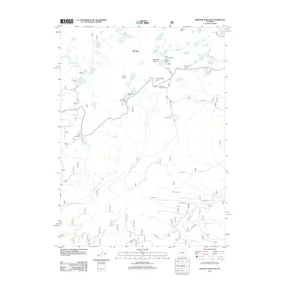
2012 Map of Medicine Bow Peak
USGS Topo · Published 2012About this map
Medicine Bow Peak dominates the high alpine landscape of this 2012 survey, marking the dramatic crest of the Snowy Range. The terrain is characterized by a dense concentration of glacial lakes and reservoirs, including Silver Lake, Keystone Reservoir, and Brooklyn Lake. This era of the landscape reflects a well-established recreational infrastructure, with numerous managed sites such as the Mirror Lake Campground, Sugarloaf Recreation Area, and the Lake Marie Picnic Ground situated along the high mountain corridors.
Find a feature on this map
72 named features on this map. Tap any name to fly to it.
Don’t see what you’re looking for? This feature index may not catch every label — zoom into the map to look around manually.
Map Details
Editions of this 2012 Medicine Bow Peak Map
This is the sole edition of this map. No revisions or reprints were ever made.
Other maps of this area

1906 · Medicine Bow
USGS Topo · 1:125,000

1908 · Medicine Bow
USGS Topo · 1:125,000

1954 · Rawlins
USGS Topo · 1:250,000

1958 · Rawlins
USGS Topo · 1:250,000

1961 · Overlook Hill
USGS Topo · 1:24,000

1961 · Sand Lake
USGS Topo · 1:24,000

1961 · Medicine Bow Peak
USGS Topo · 1:24,000
1961 · Phantom Lake
USGS Topo · 1:24,000
1961 · Centennial
USGS Topo · 1:24,000
1961 · Morgan
USGS Topo · 1:24,000