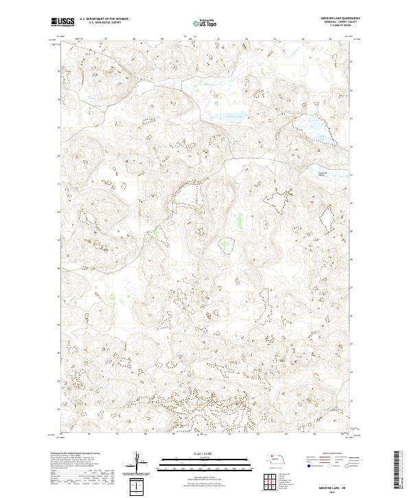
2021 Map of Medicine Lake
USGS Topo · Published 2021About this map
Medicine Lake and a collection of scattered sandhill basins define this section of Cherry County, captured during a 2021 survey. This landscape is characterized by its high-plains hydrology, where isolated water bodies like Willow Lake, Weed Lake, Gus Lake, and the larger Moon Lake dot the terrain. These lakes are connected by subtle drainage patterns and the winding course of Medicine Cr, which meanders through the northern sections of the township. In the eastern portion of the map, the topography descends into Cutcomb Valley, a distinctive landform among the rising dunes.
Find a feature on this map
12 named features on this map. Tap any name to fly to it.
Don’t see what you’re looking for? This feature index may not catch every label — zoom into the map to look around manually.
Map Details
Editions of this 2021 Medicine Lake Map
This is the sole edition of this map. No revisions or reprints were ever made.
Other maps of this area

1950 · Doughboy
USGS Topo · 1:62,500

1951 · Merriman
USGS Topo · 1:62,500

1951 · Merriman 4
USGS Topo · 1:62,500

1952 · Eli
USGS Topo · 1:62,500

1952 · Doughboy
USGS Topo · 1:62,500

1957 · Valentine
USGS Topo · 1:250,000

1959 · Valentine
USGS Topo · 1:250,000

1985 · Heath Valley
USGS Topo · 1:24,000

1985 · Eli SE
USGS Topo · 1:24,000
1985 · Farm Flat
USGS Topo · 1:24,000