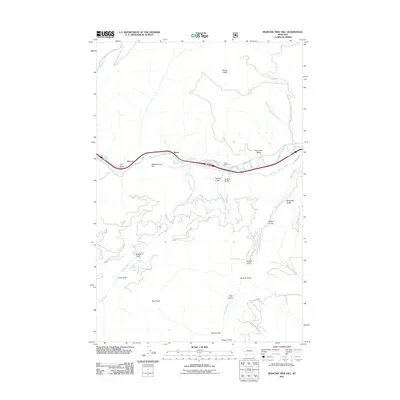
2011 Map of Medicine Tree Hill
USGS Topo · Published 2011About this map
Byrne and Nimrod sit along the northern banks of the Clark Fork, marking a corridor of transportation and settlement in the early 21st century. This landscape is defined by its deep drainages and prominent peaks, including the elevation at Medicine Tree Hill and the northern heights of Mount Baldy. The map reveals a complex network of gulches—such as Tendoy, Genoa Gulch, and Van Curan Gulch—that feed into the river valley from the surrounding highlands. South of the river, Tyler Creek and Harvey Creek create intricate patterns through the terrain, passing landmarks like Tyler Point and Welch Gulch. A significant historical artery, the Mullan Rd, is noted in the northeastern corner, tracing the path of early territorial travel. The settlement at Chalet Bearmouth further illustrates the localized development focused along the primary valley through this part of Granite County.
Find a feature on this map
27 named features on this map. Tap any name to fly to it.
Don’t see what you’re looking for? This feature index may not catch every label — zoom into the map to look around manually.
Map Details
Editions of this 2011 Medicine Tree Hill Map
This is the sole edition of this map. No revisions or reprints were ever made.
Other maps of this area

1903 · Bonner
USGS Topo · 1:125,000

1919 · Drummond
USGS Topo · 1:125,000

1921 · Drummond
USGS Topo · 1:125,000

1947 · Butte
USGS Topo · 1:250,000

1958 · Butte
USGS Topo · 1:250,000

1959 · Bearmouth
USGS Topo · 1:62,500

1959 · Ravenna
USGS Topo · 1:62,500

1960 · Butte
USGS Topo · 1:250,000

1962 · Butte
USGS Topo · 1:250,000

1965 · Union Peak
USGS Topo · 1:24,000