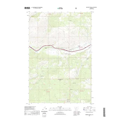
2020 Map of Medicine Tree Hill
USGS Topo · Published 2020About this map
Byrne serves as a small point of reference along the Clark Fork river in this 2020 survey of Western Montana. The landscape is defined by the sharp transition between the river valley and the high peaks of the Lolo National Forest, including the prominent Medicine Tree Hill and Mt Baldy. The historical significance of the corridor is marked by the presence of Mullan Rd, following the path of the original wagon route through the mountains. To the south, the terrain becomes increasingly complex, characterized by numerous gulches such as Genoa Gulch and Tendoy Gulch that drain toward the main valley. The map documents the boundary between Missoula and Granite counties, illustrating how the natural topography of ridges like Harvey Ridge and drainages like Tyler Cr have influenced modern land management and road networks such as Drummond Frontage Rd.
Find a feature on this map
47 named features on this map. Tap any name to fly to it.
Don’t see what you’re looking for? This feature index may not catch every label — zoom into the map to look around manually.
Map Details
Editions of this 2020 Medicine Tree Hill Map
This is the sole edition of this map. No revisions or reprints were ever made.
Other maps of this area

1903 · Bonner
USGS Topo · 1:125,000

1919 · Drummond
USGS Topo · 1:125,000

1921 · Drummond
USGS Topo · 1:125,000

1947 · Butte
USGS Topo · 1:250,000

1958 · Butte
USGS Topo · 1:250,000

1959 · Bearmouth
USGS Topo · 1:62,500

1959 · Ravenna
USGS Topo · 1:62,500

1960 · Butte
USGS Topo · 1:250,000

1962 · Butte
USGS Topo · 1:250,000

1965 · Union Peak
USGS Topo · 1:24,000