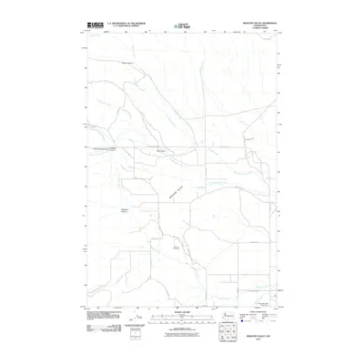
2011 Map of Medicine Valley
USGS Topo · Published 2011About this map
Medicine Valley is the primary geographic feature of this Yakima County landscape, defined by an intricate network of waterways and canyon systems. The valley floor is shaped by the confluence of North Medicine Creek and South Medicine Creek, while further south, the Simcoe Creek drainage is supported by infrastructure like the White Swan Mill Ponds Dam near Agency Creek. This 2011 survey captures the area's rural road network, dominated by Bureau of Indian Affairs routes such as BIA 4 Rd and BIA 12 Rd, which connect the scattered canyons and valleys. The presence of Yesmowit Cemetery near the center of the quadrangle provides a significant anchor for local history and genealogical research. The northern reaches are more topographically diverse, featuring Poison Canyon, Hog Canyon, and the headwaters of Patemas Creek, showing the transition from higher terrain into the fertile valley bottom.
Find a feature on this map
37 named features on this map. Tap any name to fly to it.
Don’t see what you’re looking for? This feature index may not catch every label — zoom into the map to look around manually.
Map Details
Editions of this 2011 Medicine Valley Map
This is the sole edition of this map. No revisions or reprints were ever made.
Other maps of this area

1899 · Ellensburg
USGS Topo · 1:125,000

1901 · Ellensburg
USGS Topo · 1:125,000

1937 · White Swan
USGS Topo · 1:125,000

1950 · Yakima
USGS Topo · 1:250,000

1957 · Yesmowit Canyon
USGS Topo · 1:24,000
1957 · Willy Dick Canyon
USGS Topo · 1:24,000

1958 · Toppenish Mtn.
USGS Topo · 1:24,000

1958 · Fort Simcoe
USGS Topo · 1:24,000

1958 · Fort Simcoe
USGS Topo · 1:62,500

1958 · Wiley City
USGS Topo · 1:24,000