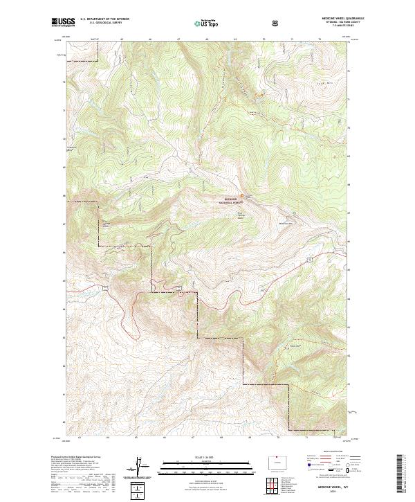
2021 Map of Medicine Wheel
USGS Topo · Published 2021About this map
Bighorn National Forest contains the sacred Medicine Wheel landmark atop Medicine Mtn, a focal point of this high-elevation survey. The landscape is defined by dramatic vertical relief, from the depths of Devil Canyon and Tillets Hole to the heights of Cone Mtn. A complex network of historic routes and modern paths, such as the Old Highway Trl and Bucking Mule Falls Trl, provide access to the area's natural landmarks, including Porcupine Falls and the vast Five Springs Basin. The drainage patterns are intricate, with Crystal Cr and Porcupine Cr cutting through the terrain, while landmarks like Lowmiller Bench offer clear geographic markers for researchers and surveyors of the Big Horn region.
Find a feature on this map
35 named features on this map. Tap any name to fly to it.
Don’t see what you’re looking for? This feature index may not catch every label — zoom into the map to look around manually.
Map Details
Editions of this 2021 Medicine Wheel Map
This is the sole edition of this map. No revisions or reprints were ever made.
Other maps of this area

1898 · Bald Mountain
USGS Topo · 1:125,000

1901 · Bald Mountain
USGS Topo · 1:125,000

1955 · Cody
USGS Topo · 1:250,000

1955 · Sheridan
USGS Topo · 1:250,000

1958 · Cody
USGS Topo · 1:250,000

1958 · Sheridan
USGS Topo · 1:250,000

1960 · Medicine Wheel
USGS Topo · 1:24,000

1960 · Boyd Ridge
USGS Topo · 1:24,000

1960 · Mexican Hill
USGS Topo · 1:24,000

1960 · Bear Creek Ranch
USGS Topo · 1:24,000