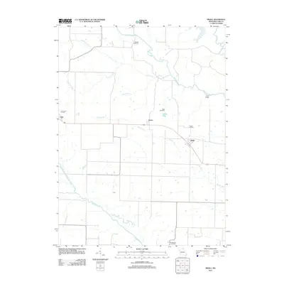
2012 Map of Medill
USGS Topo · Published 2012About this map
Ashton and Medill serve as the primary focal points of this Clark County landscape, where small-scale settlements are defined by their proximity to the winding tributaries of the Fox River. The map reveals a rural geography intricately carved by water, including the Wyaconda River and the Old Channel North Wyaconda River to the south. Local infrastructure is marked by several impoundments such as the Seyb Lake Dam and Murphy Lake Dam, which create small reservoirs like Ashton Lake across the drainage basins of Honey Creek and Linn Creek. Genealogists will find particular value in the documentation of the Medill Cemetery and Zimmerman Cemetery, alongside the small hamlet of Luray on the western edge. The presence of Drew Bridge over the Little Fox River highlights the localized transportation network connecting these agricultural communities.
Find a feature on this map
20 named features on this map. Tap any name to fly to it.
Don’t see what you’re looking for? This feature index may not catch every label — zoom into the map to look around manually.
Map Details
Editions of this 2012 Medill Map
This is the sole edition of this map. No revisions or reprints were ever made.
Other maps of this area

1903 · Kahoka
USGS Topo · 1:125,000

1949 · Kahoka
USGS Topo · 1:24,000

1949 · St. Patrick
USGS Topo · 1:24,000

1950 · Kahoka
USGS Topo · 1:24,000

1950 · Saint Patrick
USGS Topo · 1:24,000

1950 · Neeper
USGS Topo · 1:24,000

1950 · Medill
USGS Topo · 1:24,000

1950 · Colony
USGS Topo · 1:24,000

1951 · Colony
USGS Topo · 1:24,000

1951 · Neeper
USGS Topo · 1:24,000