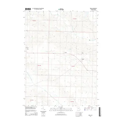
2014 Map of Medill
USGS Topo · Published 2014About this map
The Wyaconda River and Little Fox River systems carve a distinctive drainage pattern through this Clark County landscape, where agriculture and river-valley topographies meet. Small agrarian clusters like Ashton and Medill anchor the central portion of the map along Highway 136, illustrating the long-standing importance of this east-west transit corridor. To the west, the settlement of Luray is marked by the presence of Zimmerman Cemetery, while the Medill Cemetery serves as a genealogical landmark further east. Significant water features such as Ashton Lake, Honey Creek, and the Old Channel North Wyaconda River reveal the complex hydrology of the region, including how local streams have been altered or bypassed over time. The northern reaches are defined by the convergence of N Linn Creek and S Linn Creek, which join near the Fox River.
Find a feature on this map
24 named features on this map. Tap any name to fly to it.
Don’t see what you’re looking for? This feature index may not catch every label — zoom into the map to look around manually.
Map Details
Editions of this 2014 Medill Map
This is the sole edition of this map. No revisions or reprints were ever made.
Other maps of this area

1903 · Kahoka
USGS Topo · 1:125,000

1949 · Kahoka
USGS Topo · 1:24,000

1949 · St. Patrick
USGS Topo · 1:24,000

1950 · Kahoka
USGS Topo · 1:24,000

1950 · Saint Patrick
USGS Topo · 1:24,000

1950 · Neeper
USGS Topo · 1:24,000

1950 · Medill
USGS Topo · 1:24,000

1950 · Colony
USGS Topo · 1:24,000

1951 · Colony
USGS Topo · 1:24,000

1951 · Neeper
USGS Topo · 1:24,000