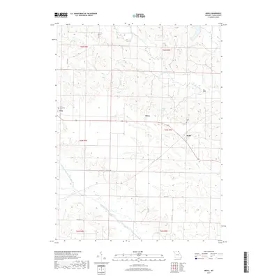
2017 Map of Medill
USGS Topo · Published 2017About this map
The Wyaconda River and the Little Fox River define the rural topography of this section of Clark County, where small agricultural settlements are connected by a network of state routes. The community of Medill serves as a central point, positioned near the junction of several drainage systems including Honey Cr and the Linn Creek valley. For genealogists, the map reveals the locations of the Zimmerman Cem near Luray and the Medill Cem to the north of its namesake town. A significant hydrologic feature is the Old Channel North Wyaconda River, indicating the natural or engineered shifts in the river's path over time. These watercourses, along with smaller tributaries like Todd Br and S Linn Cr, illustrate the complex drainage patterns that have influenced land use and road placement throughout the township and range divisions.
Find a feature on this map
29 named features on this map. Tap any name to fly to it.
Don’t see what you’re looking for? This feature index may not catch every label — zoom into the map to look around manually.
Map Details
Editions of this 2017 Medill Map
This is the sole edition of this map. No revisions or reprints were ever made.
Other maps of this area

1903 · Kahoka
USGS Topo · 1:125,000

1949 · Kahoka
USGS Topo · 1:24,000

1949 · St. Patrick
USGS Topo · 1:24,000

1950 · Kahoka
USGS Topo · 1:24,000

1950 · Saint Patrick
USGS Topo · 1:24,000

1950 · Neeper
USGS Topo · 1:24,000

1950 · Medill
USGS Topo · 1:24,000

1950 · Colony
USGS Topo · 1:24,000

1951 · Colony
USGS Topo · 1:24,000

1951 · Neeper
USGS Topo · 1:24,000